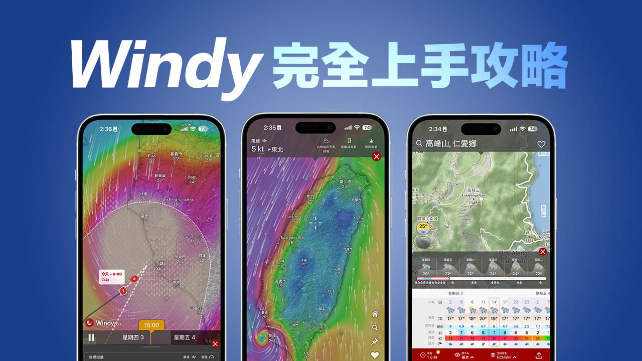
If you want to check the latest weather updates or typhoon information, you can not only check it through the Meteorological Bureau or the built-in weather app on iPhone, it provides accurate weather forecasts, and its interactive maps and rich data layers allow users to Get a deeper understanding of atmospheric changes and easily obtain detailed weather forecasts, wind direction and other information through the Windy App.
This Windy teaching technique uses the simplest graphics and text to comprehensively guide you from the basic operation of Windy to gradually understand it in depth, teaching you how to accurately grasp weather changes and understand the latest developments of typhoons like a meteorological expert, no matter you want to Whether you are hiking, traveling or doing outdoor activities, you can use this powerful weather Windy APP to make complete preparations and plan your itinerary in advance.
What is Windy?
Windy is a global interactive weather forecast platform that uses high-resolution weather models to provide high-resolution weather data around the world and provide real-time and detailed weather information. Whether you are a climber, surfer or photographer, or want to plan travel, outdoor activities or overseas itineraries, Windy can give you the most accurate weather forecast.
And Windy can not only display basic information such as wind speed, wind direction, temperature, precipitation, etc., but also more detailed meteorological parameters such as air pressure, humidity, and cloud cover. Most importantly, Windy’s data is updated frequently, allowing you to keep track of it at any time. The latest weather changes are loved by so many people.
10 Tips from Getting Started to Mastering Windy Teaching
1. Real-time dynamic weather and wind speed observation
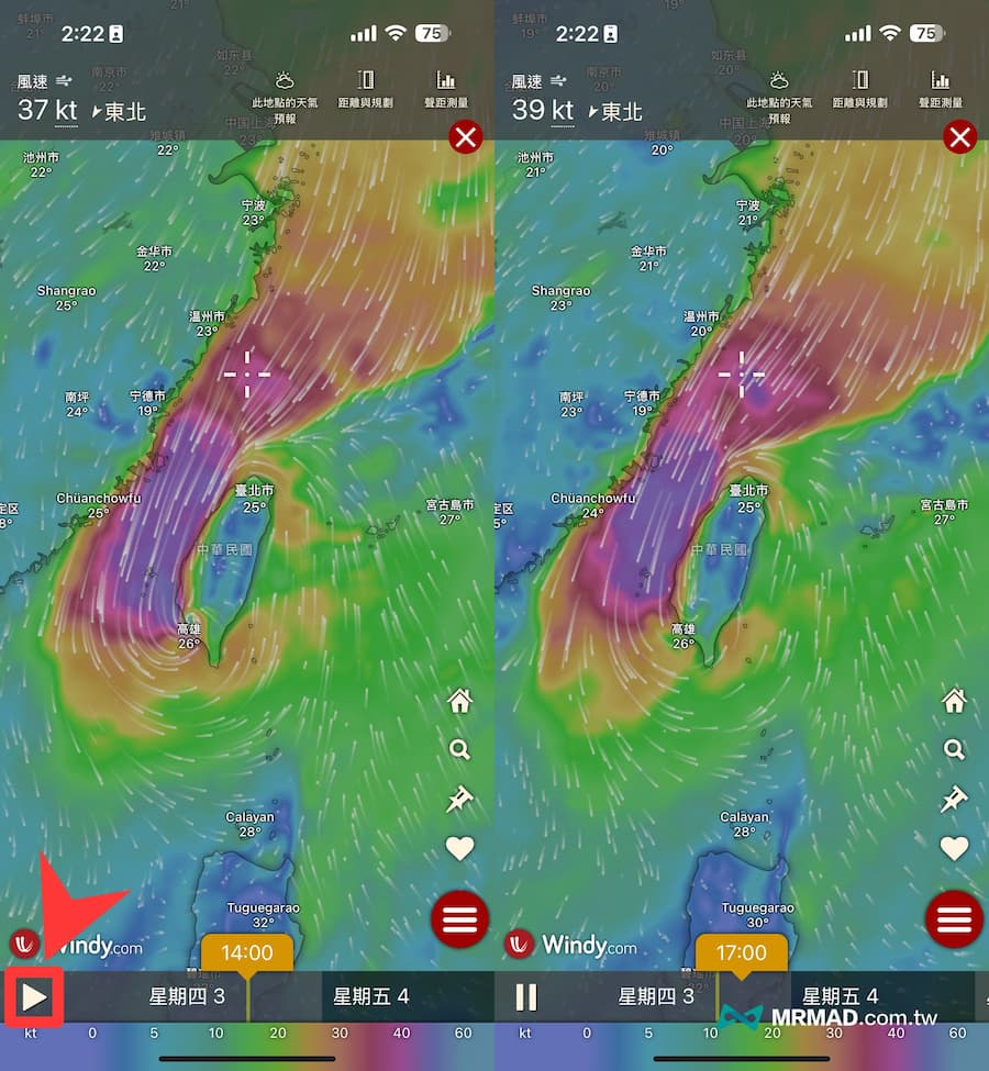
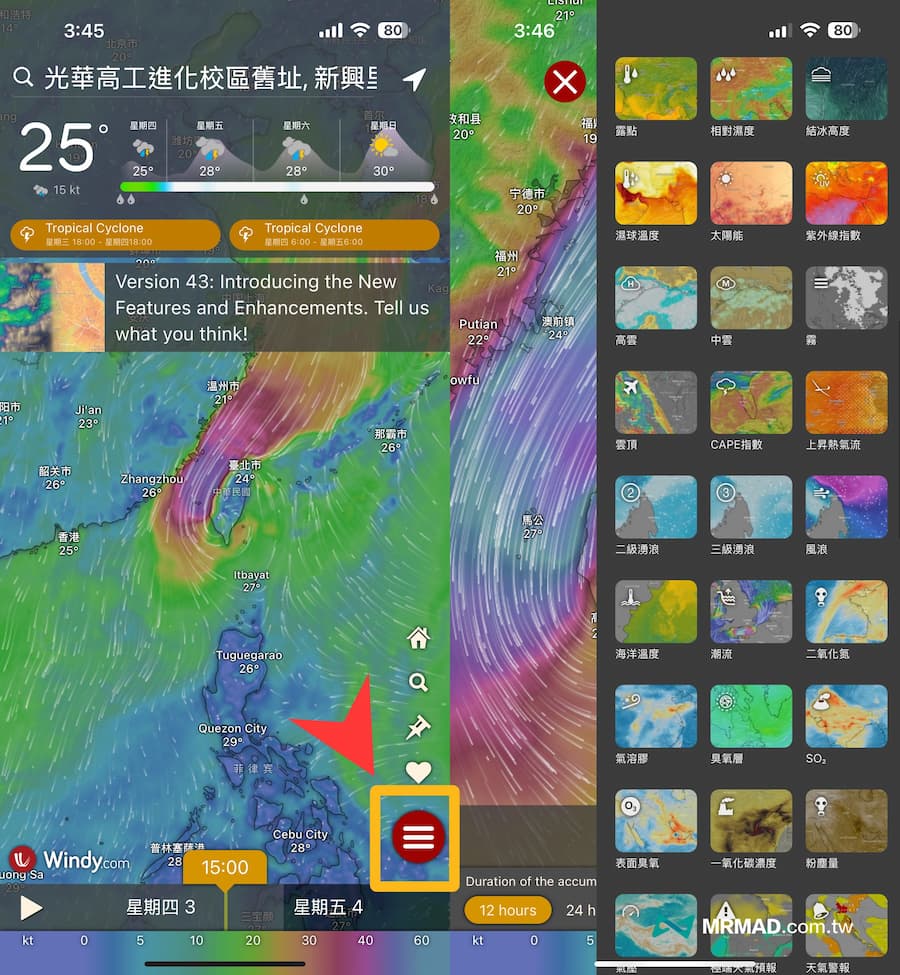
When you open the Windy App, it will provide high-resolution dynamic weather particle effects of wind direction and wind speed by default. Through the play button in the lower left corner, you can instantly see the hourly wind direction and wind speed information for a week, and even typhoon dynamics can be observed in real time.
If you want to see weather information for more than a week, you need to unlock the paid version of Windy to see it. Usually the free version is enough to observe weather information for more than a week. After all, the weather will change in the future.
2. Typhoon tracker
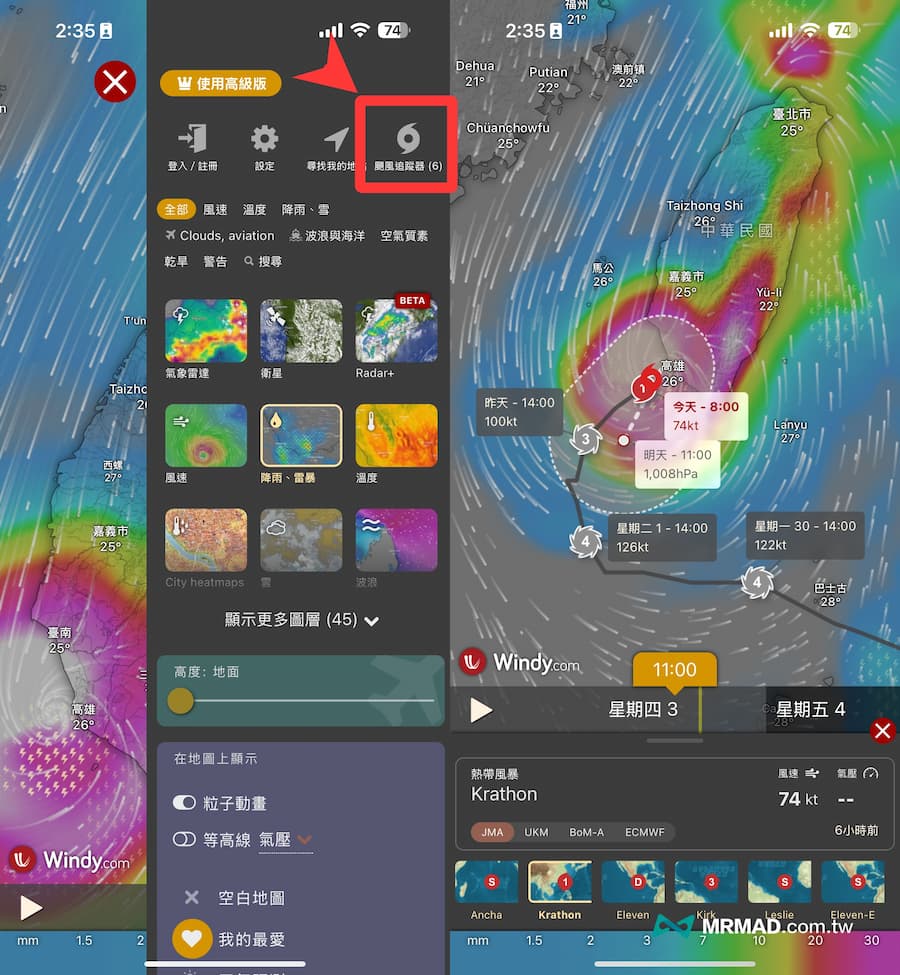
In addition to checking the location of typhoons through wind direction, Windy also has a built-in typhoon tracking function. Just click “three” in the lower right corner to bring up the function menu, and click “Typhoon Tracker” in the upper right corner to directly display the currently active typhoons. , you can view the latest typhoon detailed information, including moving path, storm circle range, central pressure, maximum wind speed, etc.
3. Multiple weather layer selections
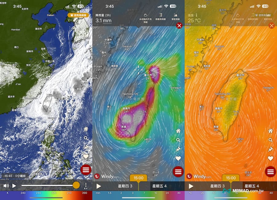
In addition to real-time observation of weather dynamics with exquisite special effects, the function menu on the right can also be used to adjust to satellite cloud images, radar images, weather radar, PM2.5, wind field images, etc. Users can select different layers according to their needs. Watch the dynamics of typhoons, and observe clouds, fog, wind waves, rainfall, etc.
For example, for outdoor activities or traveling abroad, you will also want to observe the weather conditions in advance. Sometimes, if the clouds are too thick, it will affect the safety of the flight, causing the flight to be canceled or delayed. You can use satellite cloud images to observe whether there will be too much clouds covering the day.
4. Search for attractions and city weather information
If you want to determine the weather information of a certain country or region or even scenic spots, you can directly click the “Fang Dajing” in the lower right corner of Windy to search. You can also directly enter Chinese to find information on major counties, cities and scenic spots in Taiwan.
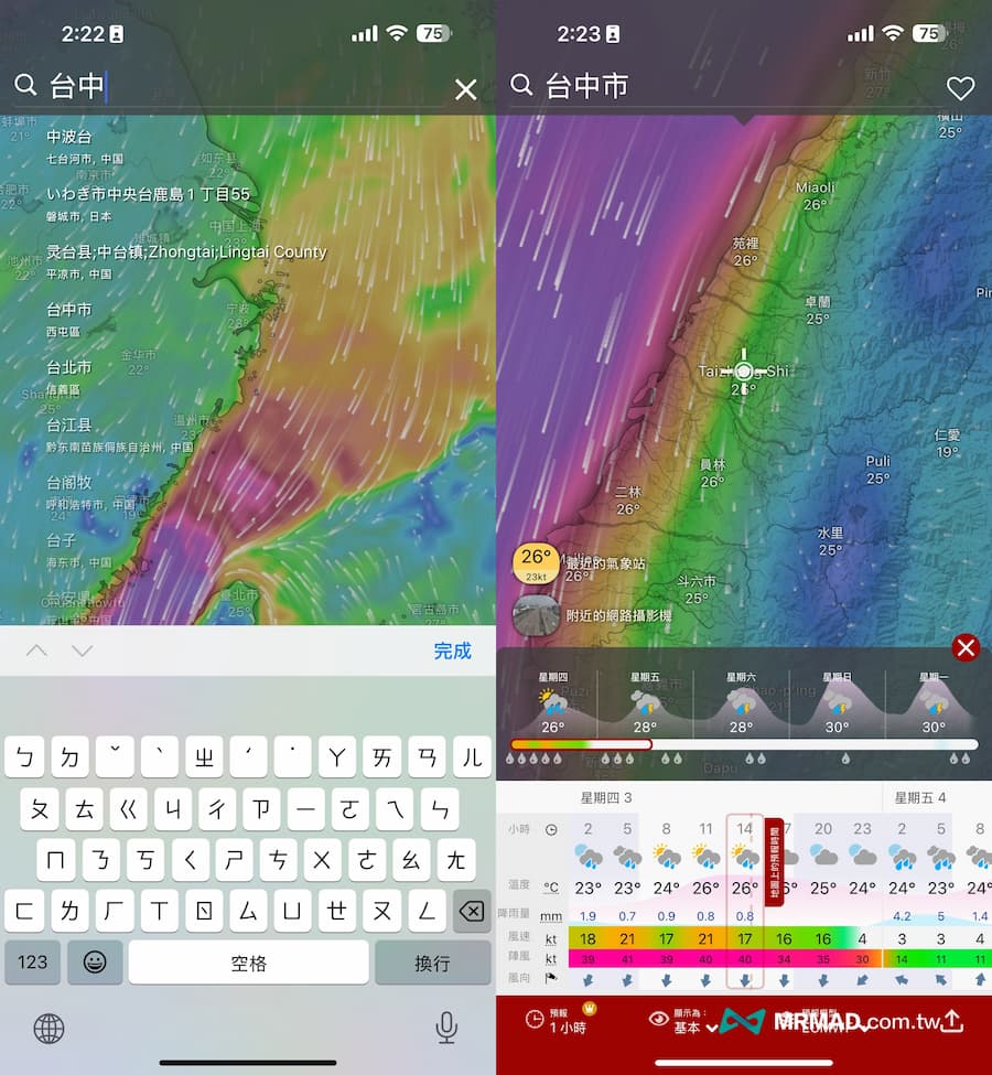
Or you can manually drag the screen and use the white aiming cross to locate and observe the weather information of the area.
5. Query the five major weather information
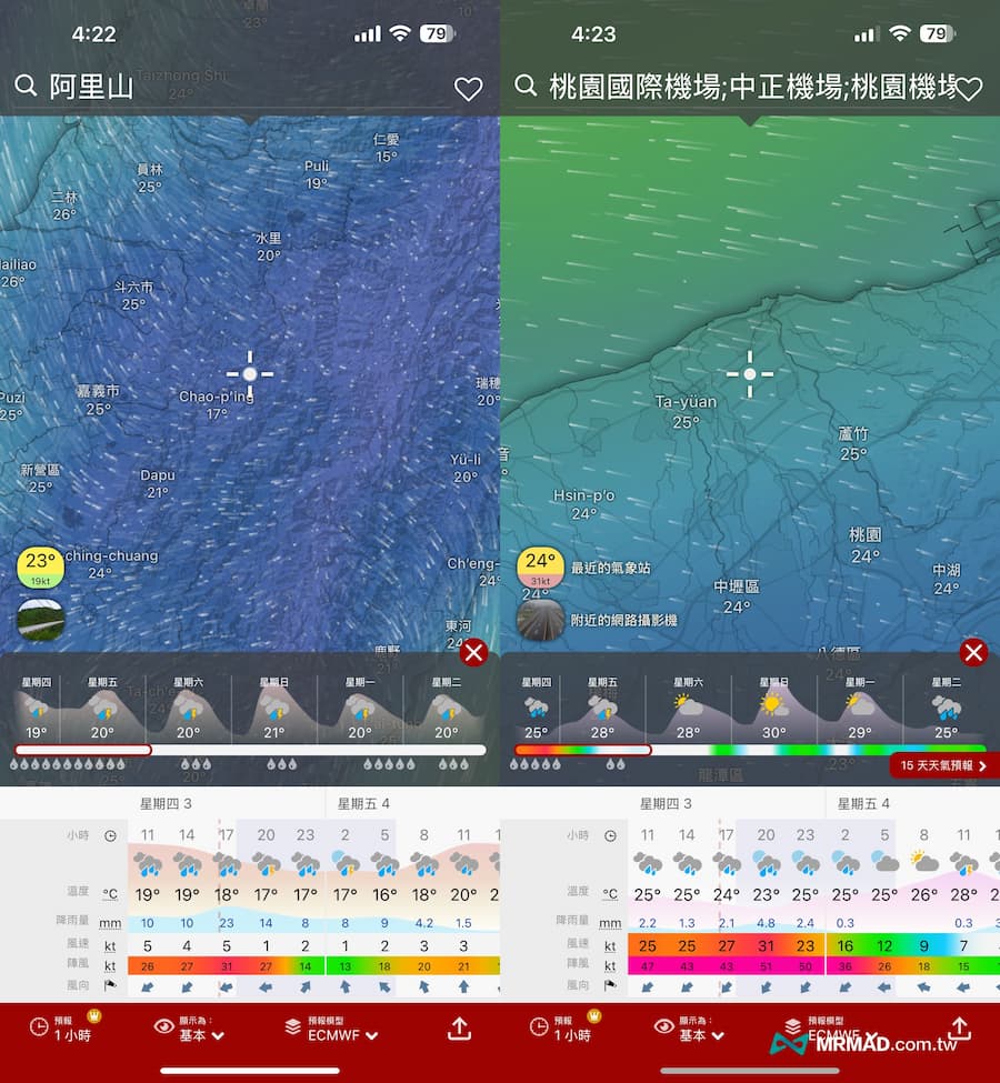
When querying the weather forecast area, the hourly weather, temperature, rainfall, wind speed, gust and wind direction information for the next six days will also be fully displayed at the bottom. It is recommended to view the mobile screen horizontally for better clarity.
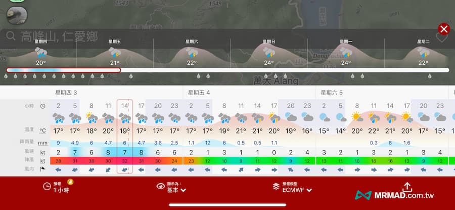
- Hourly weather: The hourly weather status will be displayed through patterns, including sunny, cloudy, overcast, rain, thunderstorm, fog, snow, etc. The icon on sunny days in the evening is the moon, and it will change with the actual moon phase (such as new moon, crescent moon, etc.) , first quarter moon, etc.).
- Temperature: The predicted temperature will be displayed, and the red-orange fluctuation line chart in the background will reflect the temperature change trend.
- Rainfall: The numerical value represents the accumulated rainfall within three hours. Use the light blue background to understand the amount of rainfall.
- Gust: represents the maximum wind speed that occurs in each time. When the value is tilted towards red, it means the stronger. As long as the value exceeds 41 or above, it represents the strong wind level (see the level for details)Beaufort wind scale).
- Wind direction: The arrow represents the direction the wind is going (as opposed to the traditional definition of wind direction).
Usually, as long as you go to mountainous areas or sea activities, such as mountain climbing, diving or boating, you can use Windy to observe weather, temperature, rainfall and wind direction information.
6. Three levels of rainfall forecast observation
Most people are most afraid of rain during outdoor activities. In fact, you can use Windy rainfall numerical observation to judge the probability of rain by yourself. Just change the right menu to the “Rainfall, Snow” layer, and change it to Judging by the type and three rainfall levels, you will know whether you need to wear more waterproof jackets and rain gear:
- Rainfall less than 1mm: clothes may be slightly wet and fog and rain may occur.
- Rainfall 1-10mm: There will be light rain and you need to wear a waterproof jacket, and there may be water on the road.
- If the rainfall is higher than 10mm: there will be moderate to heavy rains that will seriously obstruct the view, so you need to wear waterproof jackets and rain boots.
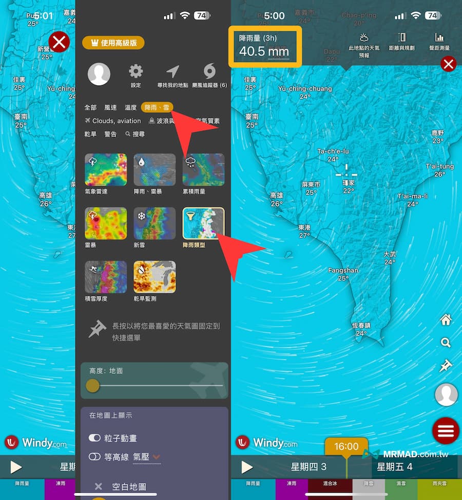
Of course, we should also remind you to observe the probability of rainfall. You need to look at the duration and spatial distribution to be more accurate. If the weather on that day shows more clouds, it does not mean that there will be no guarantee that there will be no rainfall. It is recommended to use the Windy “cloud” layer to judge , can we accurately predict the location and amount of rainfall.
7. Use humidity forecast to grasp the probability of rainfall
If you are hiking or arranging activities in deep mountains, and you want to know the rainfall forecast more accurately, you need to use Windy Humidity Assist to judge the probability of rainfall and check the relative humidity data of a specific mountainous area. Please follow the steps below:
- Click on the Windy side toolbar and first adjust the altitude (the height of the mountainous area you plan to visit).
- Switch to the “Temperature” layer.
- Select “Relative Humidity” below.
- Use the timeline to observe changes in relative humidity at different points in time.
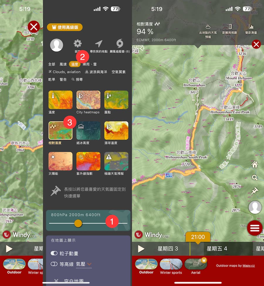
Through the changes in Windy’s hourly humidity percentage value, you can accurately grasp the probability of rainfall during that period:
- Below 50%: Chance of rainfall is extremely low, skies may be clear and cloudless
- 50%-70%: Sunny to cloudy weather possible
- 70%-80%: Mainly cloudy, possibly foggy
- 80%-90%: Heavy clouds are likely to appear, commonly known as “white walls”
- More than 90%: fog, rain or light rain is very likely to occur
8. Differences in forecast models
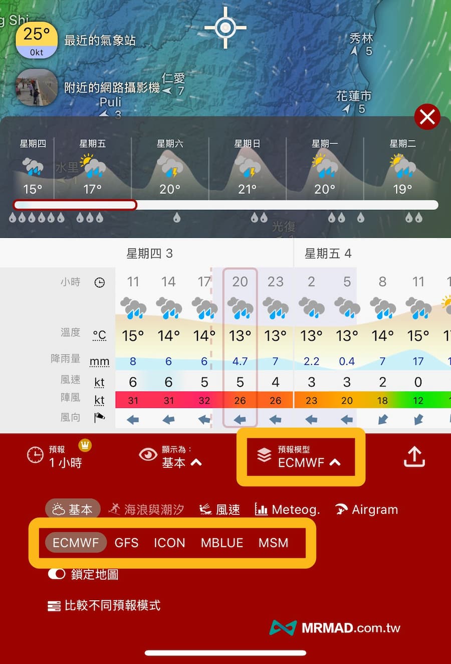
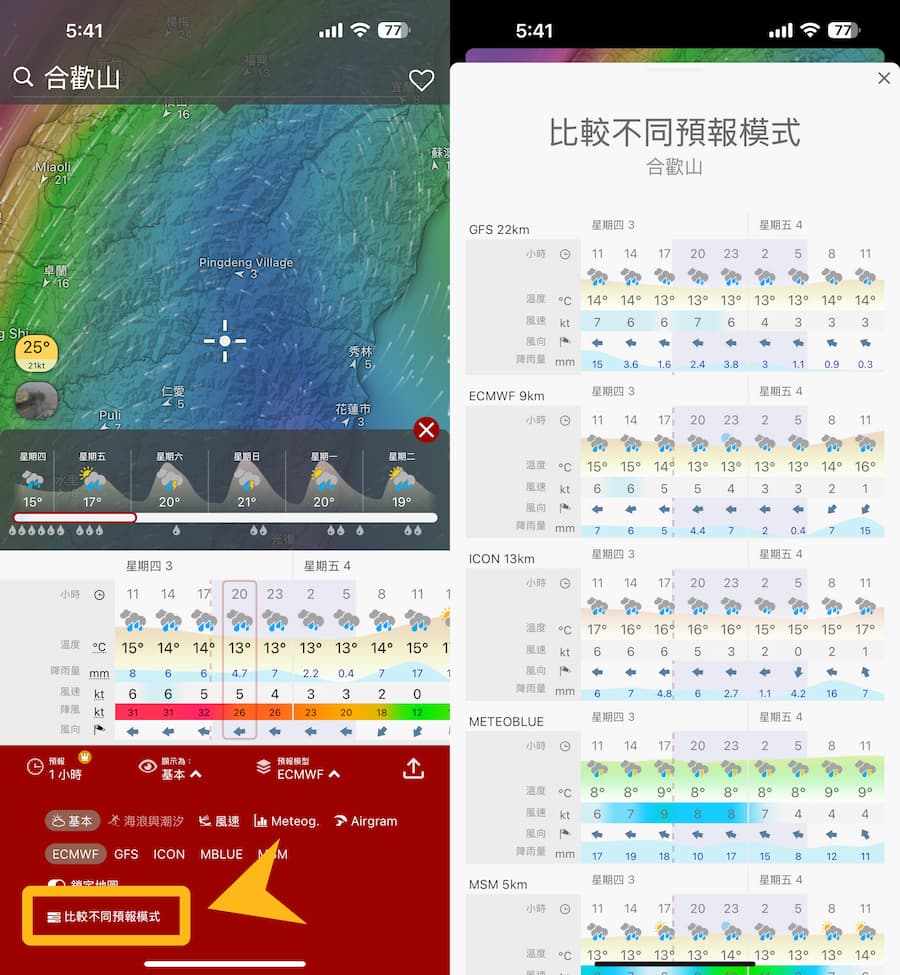
Usually the weather forecast information presented by Windy is calculated by computer, but at the bottom it can also be customized to allow us to choose which forecast model to apply:
- ECMWF (referred to as EC): Taiwan and East Asia and Europe.
- NCEP-GFS (GFS for short): The United States’ Global Forecast System.
- ICON: Courtesy of the German Weather Service DWD.
- MBLUE
- MSM
It can usually be adjusted according to different countries and regions. If you are in Taiwan or Asia, you can basically maintain the ECMWF forecast model, and the data is relatively accurate. Unless you go to the United States, you need to change the NCEP-GFS.
9. Compare different forecast models
Of course, you can also click “Compare Different Forecast Models” at the bottom of Windy to view weather forecast model data for different countries on the same page.
10. Create a city weather information list
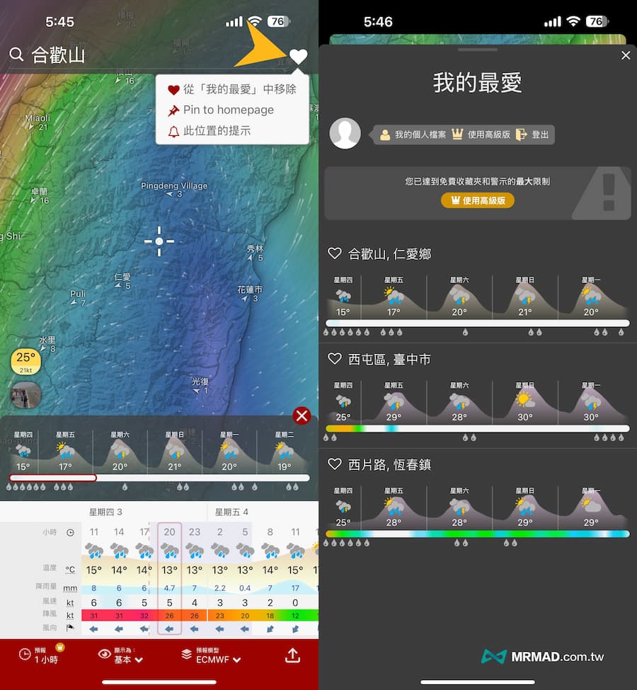
You can also track attractions or places. Just click “Add to Favorites” in the upper right corner after searching, and click on the avatar from the Windy side list to display the list of favorites. A free account can add up to three favorites. Locations of scenic spots in counties and cities.
Function summary
The above are the complete tips for getting started with the Windy weather forecast tool. Through this relatively simple graphic explanation, more people can understand how to use Windy. Whether it is typhoon, rainfall or wind direction, or any weather information, they can easily query it.
Further reading: